
1951 Map of Oil Mountain
USGS Topo · Published 1952About this map
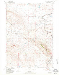
Oil Mountain dominates the landscape of Natrona County in the early 1950s, serving as a focal point for petroleum exploration and historic overland travel. The terrain is marked by an extensive network of industrial and agricultural infrastructure, including an Oil Well (Inactive), several Oil Fields, and Oil Sumps. Water management is critical in this arid environment, evidenced by the Johnson Ditch, a Canal, and numerous Levees that guide flow toward the Johnson Reservoir.
Find a feature on this map
20 named features on this map. Tap any name to fly to it.
Don’t see what you’re looking for? This feature index may not catch every label — zoom into the map to look around manually.
Map Details
Editions of this 1951 Oil Mountain Map
3 editions found
Other maps of this area

1950 · Emigrant Gap
USGS Topo · 1:24,000

1950 · Emigrant Gap NE
USGS Topo · 1:24,000

1951 · Clarkson Hill
USGS Topo · 1:24,000

1951 · Emigrant Gap NW
USGS Topo · 1:24,000

1951 · Poison Spider
USGS Topo · 1:24,000

1951 · Bessemer Mountain
USGS Topo · 1:24,000

1951 · Benton Basin NE
USGS Topo · 1:24,000

1951 · Reid Canyon
USGS Topo · 1:24,000

1955 · Casper
USGS Topo · 1:250,000

1958 · Casper
USGS Topo · 1:250,000