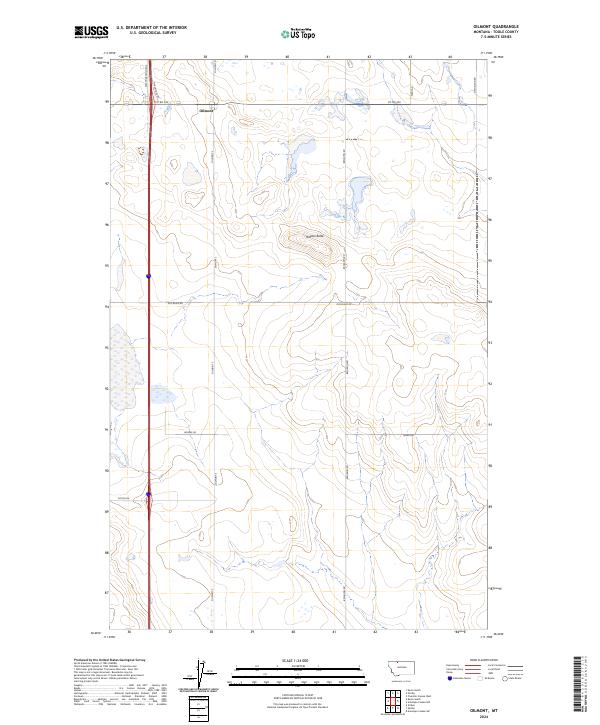
2024 Map of Oilmont
USGS Topo · Published 2024About this map
Oilmont sits at the northern edge of this high plains landscape in Toole County, where the topography is defined by the subtle rises and coulees characteristic of north-central Montana. The terrain is dominated by wide open stretches and significant landmarks like Raglan Butte, which rises above the surrounding sections. This 2024 survey reflects the modern road network and land divisions of the Public Land Survey System, including t35n r2w and t34n r1w. The transportation infrastructure is anchored by Interstate 15 and its supporting Westside Frontage, while a grid of rural routes such as Gus Blaze Rd, Potter Rd, and Rogers Rd connect the scattered homesteads and agricultural tracts of the region. The map provides a clear look at the enduring rural character of the area near the Canadian border.
Find a feature on this map
20 named features on this map. Tap any name to fly to it.
Don’t see what you’re looking for? This feature index may not catch every label — zoom into the map to look around manually.
Map Details
Editions of this 2024 Oilmont Map
This is the sole edition of this map. No revisions or reprints were ever made.
Other maps of this area

1939 · Sunburst
USGS Topo · 1:62,500

1943 · Antelope Coulee
USGS Topo · 1:62,500

1943 · Shelby
USGS Topo · 1:62,500

1945 · West Butte
USGS Topo · 1:62,500

1954 · Shelby
USGS Topo · 1:250,000

1958 · Shelby
USGS Topo · 1:250,000

1984 · Sweet Grass Hills
USGS Topo · 1:100,000
1986 · Virden
USGS Topo · 1:24,000
1986 · Antelope Coulee SW
USGS Topo · 1:24,000
1986 · Shelby
USGS Topo · 1:24,000