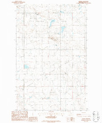
1986 Map of Oilmont
USGS Topo · Published 1986About this map
Oilmont stands as a focal point of this industrial landscape in the mid-1980s, serving as a hub for the extensive Kevin Sunburst Oil Field. The terrain is defined by a dense network of pipelines, tank batteries, and well sites that sprawl across the northern Montana prairie. Notable topographical landmarks such as Raglan Butte and the broad expanse of Prairie Dell interrupt the geometric grid of access roads and section lines. The map also records essential infrastructure of the era, including a prominent Pumping Station and a localized Substation. The presence of several areas marked as Alkali Flat suggests the arid, alkaline nature of the basins here, contrasting with the intense extraction activities that dominate the physical geography of Toole County during this period of development.
Find a feature on this map
10 named features on this map. Tap any name to fly to it.
Don’t see what you’re looking for? This feature index may not catch every label — zoom into the map to look around manually.
Map Details
Editions of this 1986 Oilmont Map
This is the sole edition of this map. No revisions or reprints were ever made.
Other maps of this area

1939 · Sunburst
USGS Topo · 1:62,500

1943 · Antelope Coulee
USGS Topo · 1:62,500

1943 · Shelby
USGS Topo · 1:62,500

1945 · West Butte
USGS Topo · 1:62,500

1954 · Shelby
USGS Topo · 1:250,000

1958 · Shelby
USGS Topo · 1:250,000

1984 · Sweet Grass Hills
USGS Topo · 1:100,000
1986 · Virden
USGS Topo · 1:24,000
1986 · Antelope Coulee SW
USGS Topo · 1:24,000
1986 · Shelby
USGS Topo · 1:24,000