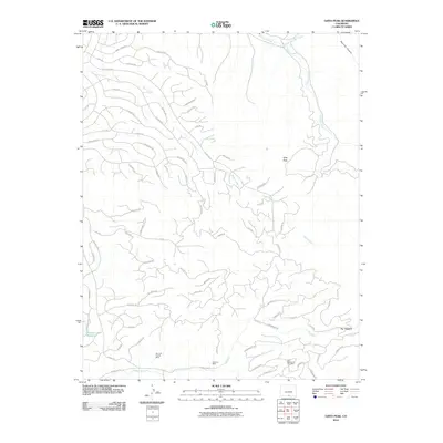
2010 Map of Ojito Peak
USGS Topo · Published 2010About this map
Ojito Peak rises as the central landmark in this high-altitude landscape of Costilla County, where the southern Colorado terrain is defined by its industrial activity and a complex network of private and access roads. The presence of the San Luis Project Mine, El Plomo Mine, and the East Blackmore Tract Mine in the southern portion of the map indicates a region heavily influenced by contemporary mineral extraction.
Find a feature on this map
73 named features on this map. Tap any name to fly to it.
Don’t see what you’re looking for? This feature index may not catch every label — zoom into the map to look around manually.
Map Details
Editions of this 2010 Ojito Peak Map
This is the sole edition of this map. No revisions or reprints were ever made.
Other maps of this area

1954 · Trinidad
USGS Topo · 1:250,000

1955 · Trinidad
USGS Topo · 1:250,000

1958 · Trinidad
USGS Topo · 1:250,000

1959 · Trinidad
USGS Topo · 1:250,000

1963 · Mc Carty Park
USGS Topo · 1:24,000

1967 · San Luis
USGS Topo · 1:24,000

1967 · Fort Garland SW
USGS Topo · 1:24,000

1967 · Ojito Peak
USGS Topo · 1:24,000
1967 · Trinchera Ranch
USGS Topo · 1:24,000
1967 · Fort Garland
USGS Topo · 1:24,000