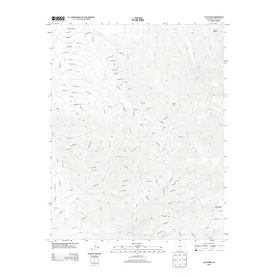
2013 Map of Ojito Peak
USGS Topo · Published 2013About this map
Ojito Peak serves as the focal point for this section of the Sangre de Cristo foothills, where the high-altitude terrain is defined by a dense network of mountain roads and drainage basins. The landscape is carved by watercourses such as Sawmill Gulch and Ojito Cr, which feed toward the south and west. Many of the local routes, including Trujillo Rd and San Miguel Rd, appear to follow the contours of the rising elevation, providing access to more remote locations like Squirrel Canyon and the high flats of Big Meadow.
Find a feature on this map
96 named features on this map. Tap any name to fly to it.
Don’t see what you’re looking for? This feature index may not catch every label — zoom into the map to look around manually.
Map Details
Editions of this 2013 Ojito Peak Map
This is the sole edition of this map. No revisions or reprints were ever made.
Other maps of this area

1954 · Trinidad
USGS Topo · 1:250,000

1955 · Trinidad
USGS Topo · 1:250,000

1958 · Trinidad
USGS Topo · 1:250,000
1959 · Trinidad
USGS Topo · 1:250,000
1963 · Mc Carty Park
USGS Topo · 1:24,000
1967 · San Luis
USGS Topo · 1:24,000
1967 · Fort Garland SW
USGS Topo · 1:24,000
1967 · Ojito Peak
USGS Topo · 1:24,000
1967 · Trinchera Ranch
USGS Topo · 1:24,000
1967 · Fort Garland
USGS Topo · 1:24,000