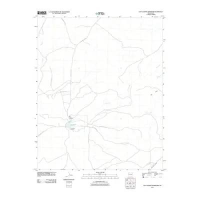
2010 Map of Ojo Caliente Reservoir
USGS Topo · Published 2010About this map
Ojo Caliente sits as a central point of human geography in this landscape defined by seasonal water and indigenous service routes. The settlement's proximity to the Ojo Caliente Reservoir, held back by the Ojo Caliente Lake Dam, highlights the critical role of water management in this arid region. Significant spiritual or natural landmarks such as Sacred Spring and Rainbow Spring are identified near the reservoir, indicating sites of local importance. The terrain is deeply grooved by drainage systems like Willow Wash and Plumasano Wash, which eventually contribute to the Zuni River in the northwest. To the east, the elevation rises toward the prominent Red Mesa, while the southern reaches of the quadrangle are marked by the descent into Yellowrock Canyon. A complex network of Indian Service Routes, including Indian Service Route 2 and Indian Service Route 21, provides the primary infrastructure connecting these remote points.
Find a feature on this map
21 named features on this map. Tap any name to fly to it.
Don’t see what you’re looking for? This feature index may not catch every label — zoom into the map to look around manually.
Map Details
Editions of this 2010 Ojo Caliente Reservoir Map
This is the sole edition of this map. No revisions or reprints were ever made.
Other maps of this area

1886 · St Johns
USGS Topo · 1:250,000

1886 · Wingate
USGS Topo · 1:250,000

1886 · Fort Defiance
USGS Topo · 1:250,000

1892 · Fort Defiance
USGS Topo · 1:250,000

1892 · St Johns
USGS Topo · 1:250,000

1892 · Wingate
USGS Topo · 1:250,000

1954 · Saint Johns
USGS Topo · 1:250,000

1954 · Gallup
USGS Topo · 1:250,000

1957 · Saint Johns
USGS Topo · 1:250,000

1958 · Gallup
USGS Topo · 1:250,000