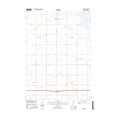
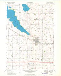
2016 Map of Okabena
USGS Topo · Published 2016About this map
Okabena anchors this southern Minnesota landscape, a community defined by its proximity to S Heron Lake and an extensive network of water management infrastructure. The town features a local Po and is surrounded by a grid of rural roads such as Okabena Rd and Co Rd 20. North of the settlement, Okabena Creek meanders toward the lake, while the surrounding prairie is heavily modified by early 21st-century drainage engineering, including Judicial Ditch Number Eightyfive and Judicial Ditch Number Thirtyone. To the south, the headwaters of the Little Sioux River begin their journey through the agricultural plains. Significant local landmarks like Saint John's Cem provide valuable points of reference for genealogists tracking families in the Rost and Okabena area, while the varied ditch systems like County Ditch Number Eleven illustrate the region's long-standing commitment to land reclamation for farming.
Find a feature on this map
33 named features on this map. Tap any name to fly to it.
Don’t see what you’re looking for? This feature index may not catch every label — zoom into the map to look around manually.
Map Details
Editions of this 2016 Okabena Map
This is the sole edition of this map. No revisions or reprints were ever made.
Other maps of this area

1954 · Fairmont
USGS Topo · 1:250,000

1958 · Fairmont
USGS Topo · 1:250,000
1960 · Brewster
USGS Topo · 1:24,000
1960 · Okabena
USGS Topo · 1:24,000
1960 · Round Lake
USGS Topo · 1:24,000
1960 · Sioux Valley
USGS Topo · 1:24,000
1970 · Lakefield SW
USGS Topo · 1:24,000
1970 · Dundee
USGS Topo · 1:24,000
1970 · Wilder
USGS Topo · 1:24,000
1970 · Lakefield
USGS Topo · 1:24,000