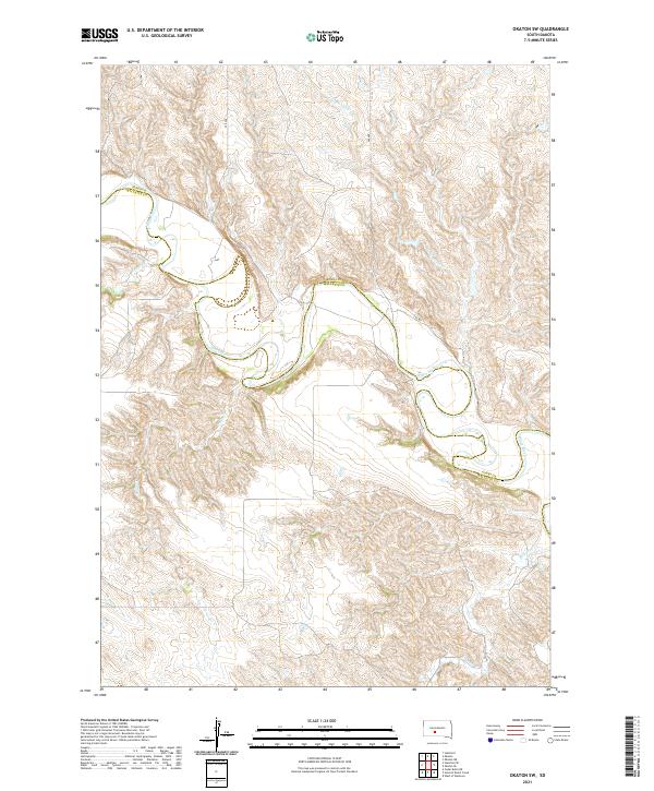
2021 Map of Okaton SW
USGS Topo · Published 2021About this map
The White River carves a winding, serpentine path across this landscape, defining the county line shared by Jones and Mellette Counties. The terrain is characterized by a series of deeply eroded drainages and tributary systems, including Cottonwood Cr and Yukon Cr to the north, while Cedar Cr and Roundup Cr flow through the southern breaks. The geographic orientation of the region is established by the local road network, specifically 259 Ave and 260 Ave, which cut across the high ground between the river valleys. This survey illustrates the intricate topography of the South Dakota plains, where the land is shaped almost entirely by the movement of water toward the river channel, creating a complex network of draws and ridges.
Find a feature on this map
16 named features on this map. Tap any name to fly to it.
Don’t see what you’re looking for? This feature index may not catch every label — zoom into the map to look around manually.
Map Details
Editions of this 2021 Okaton SW Map
This is the sole edition of this map. No revisions or reprints were ever made.
Other maps of this area

1951 · Stamford SE
USGS Topo · 1:24,000

1951 · Cedar Butte NE
USGS Topo · 1:24,000

1951 · Okaton SW
USGS Topo · 1:24,000

1951 · Murdo 3 NW
USGS Topo · 1:24,000

1951 · Murdo 3 NE
USGS Topo · 1:24,000

1951 · Okaton SE
USGS Topo · 1:24,000

1955 · Martin
USGS Topo · 1:250,000

1958 · Martin
USGS Topo · 1:250,000

1972 · Okaton
USGS Topo · 1:24,000
1972 · Okaton NE
USGS Topo · 1:24,000