1951 Map of Okaton SW
USGS Topo · Published 1979About this map
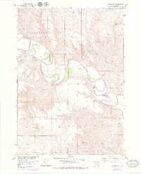
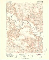
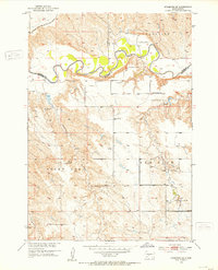
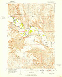
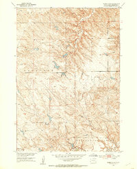
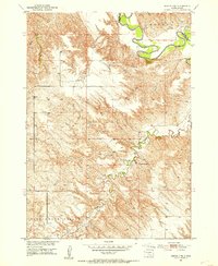
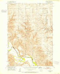
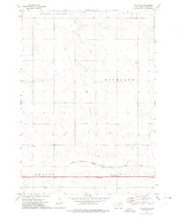
The White River meanders sharply across this mid-century landscape, defining the jagged border between Jones Co and Mellette Co. This topographic record, based on 1949 aerial photography with 1976 revisions, documents a ranching-heavy economy centered on the fertile but difficult breaks of the river valley. Numerous family holdings are mapped by name, including the Peterson Ranch, Blom Ranch, and Graham Ranch in the northwestern sector, while the Wedean Ranch and Sandy Ranch occupy the eastern bends. The topography is dominated by distinct high-ground areas labeled Grandview, Okaton, and Redfish, which overlook a network of drainages like Yukmi Creek and Cottonwood Creek. The presence of several Gravel Pits suggests localized resource extraction supporting the sparse road network of this South Dakota interior.
Find a feature on this map
18 named features on this map. Tap any name to fly to it.
Don’t see what you’re looking for? This feature index may not catch every label — zoom into the map to look around manually.
Map Details
Editions of this 1951 Okaton SW Map
3 editions found
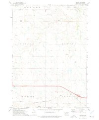
Other maps of this area
1951 · Stamford SE
USGS Topo · 1:24,000

1951 · Cedar Butte NE
USGS Topo · 1:24,000
1951 · Okaton SW
USGS Topo · 1:24,000
1951 · Murdo 3 NW
USGS Topo · 1:24,000
1951 · Murdo 3 NE
USGS Topo · 1:24,000
1951 · Okaton SE
USGS Topo · 1:24,000

1955 · Martin
USGS Topo · 1:250,000

1958 · Martin
USGS Topo · 1:250,000
1972 · Okaton
USGS Topo · 1:24,000
1972 · Okaton NE
USGS Topo · 1:24,000