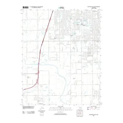
2009 Map of Oklahoma City SE
USGS Topo · Published 2009About this map
The Canadian River winds through the southern landscape of this 2009 survey, defining the transition between the growing suburbs of Oklahoma City and the town of Newcastle. The area is marked by a complex network of man-made water features and residential expansion, including Shadow Lake and numerous numbered reservoirs like Oknoname 02731 Reservoir. These water management projects, often paired with structures like the Oknoname 02728 Dam, highlight the suburban engineering required to manage the local tributaries such as Lost Creek and Boggy Creek.
Find a feature on this map
64 named features on this map. Tap any name to fly to it.
Don’t see what you’re looking for? This feature index may not catch every label — zoom into the map to look around manually.
Map Details
Editions of this 2009 Oklahoma City SE Map
This is the sole edition of this map. No revisions or reprints were ever made.
Other maps of this area

1892 · Moore
USGS Topo · 1:62,500

1893 · Norman
USGS Topo · 1:62,500

1893 · Oklahoma City
USGS Topo · 1:62,500

1898 · Purcell
USGS Topo · 1:125,000

1904 · Chickasha
USGS Topo · 1:125,000

1925 · Norman NO 2
USGS Topo · 1:24,000

1934 · Crutcho Creek
USGS Topo · 1:24,000

1934 · Moore
USGS Topo · 1:62,500

1936 · Norman
USGS Topo · 1:62,500

1938 · Moore
USGS Topo · 1:62,500