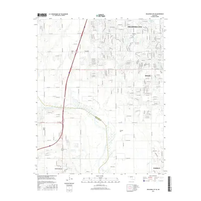
2016 Map of Oklahoma City SE
USGS Topo · Published 2016About this map
The Canadian River cuts a wide path through the southern reaches of the metropolitan area, defining the border between Cleveland Co and McClain Co. This 2016 survey documents the suburban expansion between Oklahoma City and Moore, where residential developments such as those along SW 134th St and S Portland Ave meet the open terrain of Ten Mile Flat. Significant local landmarks include Mid - America Christian University and several large memorial grounds such as Resthaven Gardens Cem and Heritage Burial Park. To the south, the landscape shifts toward the outskirts of Newcastle and Norman, marked by smaller watercourses like Pond Cr and the private Odom's Roost Airport, illustrating the transition from dense city blocks to the rural-fringe pastures and creek beds of central Oklahoma.
Find a feature on this map
206 named features on this map. Tap any name to fly to it.
Don’t see what you’re looking for? This feature index may not catch every label — zoom into the map to look around manually.
Map Details
Editions of this 2016 Oklahoma City SE Map
This is the sole edition of this map. No revisions or reprints were ever made.
Other maps of this area

1892 · Moore
USGS Topo · 1:62,500

1893 · Norman
USGS Topo · 1:62,500

1893 · Oklahoma City
USGS Topo · 1:62,500

1898 · Purcell
USGS Topo · 1:125,000

1904 · Chickasha
USGS Topo · 1:125,000

1925 · Norman NO 2
USGS Topo · 1:24,000

1934 · Crutcho Creek
USGS Topo · 1:24,000

1934 · Moore
USGS Topo · 1:62,500

1936 · Norman
USGS Topo · 1:62,500

1938 · Moore
USGS Topo · 1:62,500