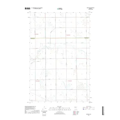
2019 Map of Oklee NW
USGS Topo · Published 2019About this map
The Clearwater River meanders across the center of this landscape, marking a transition between the northern and southern reaches of the region. This survey captures a highly managed hydraulic environment where natural watercourses are supplemented by an extensive network of drainage infrastructure, including Judicial Ditch Number One and Judicial Ditch Number Fortyone. These man-made channels, such as County Ditch Number Sixtyfour and County Ditch Number Eighteen, reflect the long-standing effort to adapt the wetland-rich terrain for agricultural use.
Find a feature on this map
33 named features on this map. Tap any name to fly to it.
Don’t see what you’re looking for? This feature index may not catch every label — zoom into the map to look around manually.
Map Details
Editions of this 2019 Oklee NW Map
This is the sole edition of this map. No revisions or reprints were ever made.
Other maps of this area

1918 · Terrebonne
USGS Topo · 1:62,500

1919 · Grit
USGS Topo · 1:62,500

1943 · Thief River Falls
USGS Topo · 1:62,500

1952 · Grand Forks
USGS Topo · 1:250,000

1952 · Thief River Falls
USGS Topo · 1:250,000

1954 · Bemidji
USGS Topo · 1:250,000

1954 · Roseau
USGS Topo · 1:250,000

1956 · Thief River Falls
USGS Topo · 1:250,000

1956 · Grand Forks
USGS Topo · 1:250,000

1957 · Roseau
USGS Topo · 1:250,000