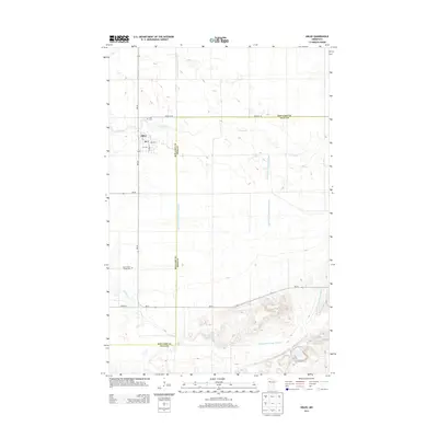
2013 Map of Oklee
USGS Topo · Published 2013About this map
Oklee serves as the primary hub in this Red Lake County landscape, situated where MN-222 enters the village from the north. The settlement is defined by its grid of local streets, including Lambert St, 3rd Ave, and 4th Ave, and is supported by a local Post Office. The surrounding terrain is a complex network of managed waterways and natural streams, where the Lost River meanders across the northern half of the quadrangle and the Hill River flows through the southwest corner.
Find a feature on this map
21 named features on this map. Tap any name to fly to it.
Don’t see what you’re looking for? This feature index may not catch every label — zoom into the map to look around manually.
Map Details
Editions of this 2013 Oklee Map
This is the sole edition of this map. No revisions or reprints were ever made.
Other maps of this area

1919 · Fosston
USGS Topo · 1:62,500

1919 · Grit
USGS Topo · 1:62,500

1919 · Winsor
USGS Topo · 1:62,500

1954 · Bemidji
USGS Topo · 1:250,000

1957 · Bemidji
USGS Topo · 1:250,000

1958 · Bemidji
USGS Topo · 1:250,000

1969 · Olga
USGS Topo · 1:24,000

1969 · Mc Intosh NE
USGS Topo · 1:24,000
1969 · Mc Intosh
USGS Topo · 1:24,000
1971 · Oklee
USGS Topo · 1:24,000