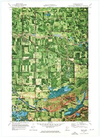
1971 Map of Oklee
USGS Topo · Published 1976About this map
The village of Oklee serves as the focal point of this Red Lake County orthophotomap, showing the landscape as it appeared in the early 1970s. This hybrid map combines traditional topographic contour lines with aerial photography, revealing the precise geometric patterns of Northwest Minnesota's agricultural fields and drainage networks. The region's hydraulic engineering is documented in detail, featuring Judicial Ditch No 4, Judicial Ditch No 71, and State DITCH No 61, which channel water toward the Lost River and Hill River.
Find a feature on this map
25 named features on this map. Tap any name to fly to it.
Don’t see what you’re looking for? This feature index may not catch every label — zoom into the map to look around manually.
Map Details
Editions of this 1971 Oklee Map
This is the sole edition of this map. No revisions or reprints were ever made.
Other maps of this area

1919 · Fosston
USGS Topo · 1:62,500

1919 · Grit
USGS Topo · 1:62,500

1919 · Winsor
USGS Topo · 1:62,500

1954 · Bemidji
USGS Topo · 1:250,000

1957 · Bemidji
USGS Topo · 1:250,000

1958 · Bemidji
USGS Topo · 1:250,000

1969 · Olga
USGS Topo · 1:24,000

1969 · Mc Intosh NE
USGS Topo · 1:24,000
1969 · Mc Intosh
USGS Topo · 1:24,000
1971 · Roland
USGS Topo · 1:24,000