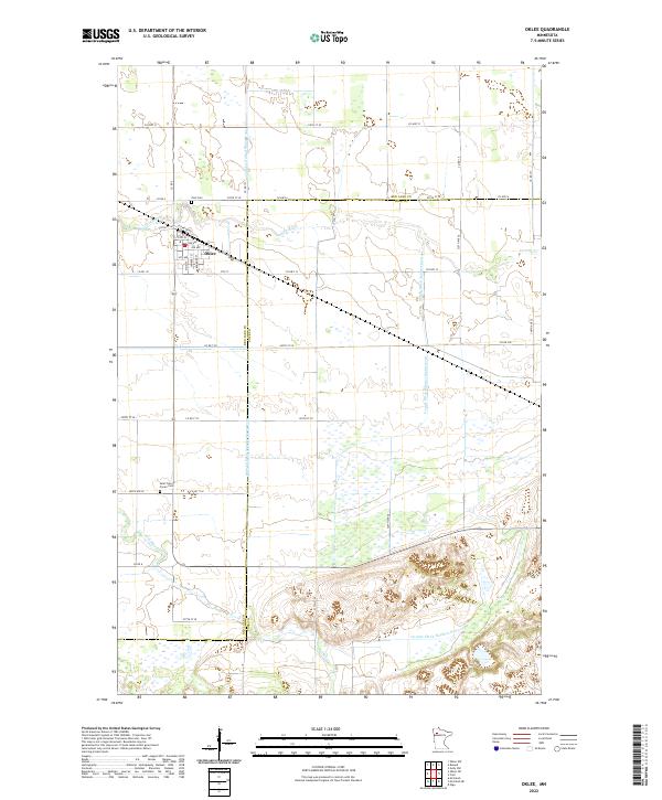
2022 Map of Oklee
USGS Topo · Published 2022About this map
Oklee serves as the central hub of this northern Minnesota landscape, situated at the intersection of several local routes like CO Hwy 6 and CO Rd 131. The town's grid is clearly defined, with streets such as Lambert St and Bourden St radiating from the core near Elevator Rd. This area reflects a highly engineered agricultural environment, where the natural course of the Lost River is augmented by an extensive network of drainage infrastructure, including the State Ditch Number Sixtyone and Judicial Ditch Number Seventyone.
Find a feature on this map
48 named features on this map. Tap any name to fly to it.
Don’t see what you’re looking for? This feature index may not catch every label — zoom into the map to look around manually.
Map Details
Editions of this 2022 Oklee Map
This is the sole edition of this map. No revisions or reprints were ever made.
Other maps of this area

1919 · Fosston
USGS Topo · 1:62,500

1919 · Grit
USGS Topo · 1:62,500

1919 · Winsor
USGS Topo · 1:62,500

1954 · Bemidji
USGS Topo · 1:250,000

1957 · Bemidji
USGS Topo · 1:250,000

1958 · Bemidji
USGS Topo · 1:250,000

1969 · Olga
USGS Topo · 1:24,000

1969 · Mc Intosh NE
USGS Topo · 1:24,000
1969 · Mc Intosh
USGS Topo · 1:24,000
1971 · Oklee
USGS Topo · 1:24,000