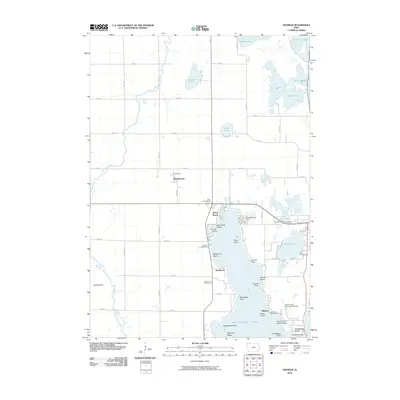
2010 Map of Okoboji
USGS Topo · Published 2010About this map
West Okoboji Lake dominates the southern landscape of this 2010 quadrangle, its shoreline crowded with recreational developments such as Triboji Beach, Omaha Beach, and Des Moines Beach. The density of points and beaches—including Manhattan Point and Papoose Beach—contrasts sharply with the rural character of the north and west, where the Little Sioux River meanders toward the CaylerPrairie preserve. Local infrastructure is well-defined, featuring the Spirit Lake Municipal Airport and the specialized Lake Okoboji Seaplane Base. This survey illustrates the mature resort economy of the Iowa Great Lakes region, showing the proximity of the Okoboji Post Office to the UnitedMethodist Camp and established golf courses. Inland, smaller water bodies like Diamond Lake and Welsh Lake remain surrounded by the section-line roads of the agricultural interior, away from the bustling lakefront at Okoboji Bridge.
Find a feature on this map
59 named features on this map. Tap any name to fly to it.
Don’t see what you’re looking for? This feature index may not catch every label — zoom into the map to look around manually.
Map Details
Editions of this 2010 Okoboji Map
This is the sole edition of this map. No revisions or reprints were ever made.
Other maps of this area

1954 · Fairmont
USGS Topo · 1:250,000

1958 · Fairmont
USGS Topo · 1:250,000

1960 · Sioux Valley
USGS Topo · 1:24,000

1970 · Milford
USGS Topo · 1:24,000

1970 · Lakefield SW
USGS Topo · 1:24,000

1970 · Okoboji
USGS Topo · 1:24,000

1970 · Lakefield SE
USGS Topo · 1:24,000

1970 · Spirit Lake SE
USGS Topo · 1:24,000

1970 · Lake Park SE
USGS Topo · 1:24,000

1970 · Spirit Lake
USGS Topo · 1:24,000