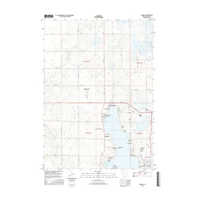
2015 Map of Okoboji
USGS Topo · Published 2015About this map
The Little Sioux River winds through the western plains of this Iowa landscape, providing a stark contrast to the dense network of glacial lakes and resort communities to the east. West Okoboji Lake dominates the central geography, its shoreline heavily partitioned into distinctive residential pockets like Triboji Beach, Manhattan Beach, and Wahpeton. The settlement of Montgomery sits inland to the northwest, while the southeastern corner is more densely developed around the town of Okoboji and the Spirit Lake Municipal Airport.
Find a feature on this map
85 named features on this map. Tap any name to fly to it.
Don’t see what you’re looking for? This feature index may not catch every label — zoom into the map to look around manually.
Map Details
Editions of this 2015 Okoboji Map
This is the sole edition of this map. No revisions or reprints were ever made.
Other maps of this area

1954 · Fairmont
USGS Topo · 1:250,000

1958 · Fairmont
USGS Topo · 1:250,000

1960 · Sioux Valley
USGS Topo · 1:24,000

1970 · Milford
USGS Topo · 1:24,000

1970 · Lakefield SW
USGS Topo · 1:24,000

1970 · Okoboji
USGS Topo · 1:24,000

1970 · Lakefield SE
USGS Topo · 1:24,000

1970 · Spirit Lake SE
USGS Topo · 1:24,000

1970 · Lake Park SE
USGS Topo · 1:24,000

1970 · Spirit Lake
USGS Topo · 1:24,000