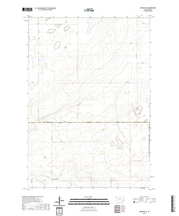
2021 Map of Okobojo SE
USGS Topo · Published 2021About this map
Gray Goose sits near the southern boundary of this central South Dakota landscape, marking a small pocket of settlement just north of the Sully Co Hughes Co line. The terrain is defined by a series of drainages, including the winding course of Cow Creek and the southern Spring Cr, which cut through the sectional grid of the Missouri River highlands. A network of rural roads like Grey Goose Rd and Juniper Pl provides access to these uplands, reflecting a modern agricultural and residential pattern established long after the initial homesteading era. The map clearly illustrates the transition between Sully and Hughes counties, showing how land use and road networks remain tightly aligned with the original Public Land Survey System townships.
Find a feature on this map
28 named features on this map. Tap any name to fly to it.
Don’t see what you’re looking for? This feature index may not catch every label — zoom into the map to look around manually.
Map Details
Editions of this 2021 Okobojo SE Map
This is the sole edition of this map. No revisions or reprints were ever made.
Other maps of this area

1924 · Pierre
USGS Topo · 1:62,500

1934 · Canning
USGS Topo · 1:48,000

1937 · Canning
USGS Topo · 1:62,500

1954 · Pierre
USGS Topo · 1:250,000

1958 · Pierre
USGS Topo · 1:250,000

1965 · Okobojo NE
USGS Topo · 1:24,000

1965 · Okobojo
USGS Topo · 1:24,000

1965 · Sully Lake
USGS Topo · 1:24,000

1967 · Pierre NE
USGS Topo · 1:24,000

1967 · Onida SW
USGS Topo · 1:24,000