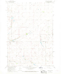
1967 Map of Okobojo SE
USGS Topo · Published 1968About this map
Gray Goose sits near the southern edge of this Missouri River Basin survey, serving as a localized point of settlement in a landscape defined by rolling topography and intermittent drainage. The terrain is marked by the presence of Spring Creek, which meanders across the lower sections of the map, and several unnamed seasonal watercourses. The infrastructure of the late 1960s is reflected in the numerous Gravel Pits and a solitary Landing Strip, indicating the reliance on local materials and small-scale aviation in this rural South Dakota corridor. The boundary between Sully Co and Hughes Co bisects the area, highlighting the administrative division of this upland prairie. Much of the map detail is dedicated to the subtle shifts in elevation and the intricate network of field lines and fences that partition the agricultural land.
Find a feature on this map
8 named features on this map. Tap any name to fly to it.
Don’t see what you’re looking for? This feature index may not catch every label — zoom into the map to look around manually.
Map Details
Editions of this 1967 Okobojo SE Map
This is the sole edition of this map. No revisions or reprints were ever made.
Other maps of this area

1924 · Pierre
USGS Topo · 1:62,500

1934 · Canning
USGS Topo · 1:48,000

1937 · Canning
USGS Topo · 1:62,500

1954 · Pierre
USGS Topo · 1:250,000

1958 · Pierre
USGS Topo · 1:250,000

1965 · Okobojo NE
USGS Topo · 1:24,000

1965 · Okobojo
USGS Topo · 1:24,000

1965 · Sully Lake
USGS Topo · 1:24,000

1967 · Pierre NE
USGS Topo · 1:24,000

1967 · Onida SW
USGS Topo · 1:24,000