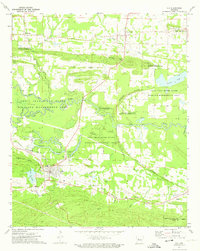
1972 Map of Ola
USGS Topo · Published 1974About this map
Ola serves as the primary hub in this early 1970s survey of the Arkansas river valley, situated where the Chicago Rock Island and Pacific railroad cuts through the gap between Danville Mtn and Ola Mountain. The landscape is dominated by the meandering course of the Petit Jean River, which creates a complex network of wetlands and seasonal water bodies including Cane Island Slough, Keeland Slough, and the large Cane Island. Much of this bottomland is preserved within the Petit Jean River State Wildlife Management Area.
Find a feature on this map
42 named features on this map. Tap any name to fly to it.
Don’t see what you’re looking for? This feature index may not catch every label — zoom into the map to look around manually.
Map Details
Editions of this 1972 Ola Map
2 editions found
Other maps of this area

1888 · Dardanelle #4
USGS Topo · 1:62,500

1888 · Dardanelle #3
USGS Topo · 1:62,500

1890 · Hot Springs
USGS Topo · 1:125,000

1890 · Dardanelle
USGS Topo · 1:125,000

1894 · Hot Springs
USGS Topo · 1:125,000

1955 · Little Rock
USGS Topo · 1:250,000

1956 · Little Rock
USGS Topo · 1:250,000

1956 · Russellville
USGS Topo · 1:250,000

1960 · Little Rock
USGS Topo · 1:250,000

1964 · Russellville
USGS Topo · 1:250,000