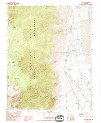
1988 Map of Olancha
USGS Topo · Published 1994About this map
Owens Lake and the eastern slopes of the Sierra Nevada define this landscape in the late twentieth century, where the high-altitude wilderness meets the arid valley floor. The settlements of Cartago and Olancha sit along the western edge of the lake bed, serving as gateways to the steep terrain of the Inyo National Forest. Infrastructure of the era is clearly marked, including the Los Angeles Aqueduct winding along the foothills and an Old Railroad Grade that traces the historic transportation corridor of the Owens Valley.
Find a feature on this map
32 named features on this map. Tap any name to fly to it.
Don’t see what you’re looking for? This feature index may not catch every label — zoom into the map to look around manually.
Map Details
Editions of this 1988 Olancha Map
2 editions found
Other maps of this area

1905 · Olancha
USGS Topo · 1:125,000

1907 · Olancha
USGS Topo · 1:125,000

1908 · Ballarat
USGS Topo · 1:250,000

1913 · Ballarat
USGS Topo · 1:250,000

1948 · Death Valley
USGS Topo · 1:250,000

1948 · Fresno
USGS Topo · 1:250,000

1951 · Keeler
USGS Topo · 1:62,500

1951 · Haiwee Reservoir
USGS Topo · 1:62,500

1954 · Death Valley
USGS Topo · 1:250,000

1955 · Fresno
USGS Topo · 1:250,000