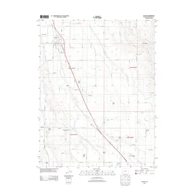
2013 Map of Olathe
USGS Topo · Published 2013About this map
The Uncompahgre River carves a fertile path through this portion of Montrose County, supporting a complex network of agricultural infrastructure including the Ironstone Canal, Selig Ditch, and Loutsenhizer Arroyo. The town of Olathe serves as the primary hub, where the Highway 50 Bus Loop meets established local routes like Co-348. Local heritage is anchored at the Olathe Cemetery and the North Mesa Community Hall, while the surrounding landscape is defined by elevated geographic features such as High Mesa, Franklin Mesa, and Spring Creek Mesa.
Find a feature on this map
65 named features on this map. Tap any name to fly to it.
Don’t see what you’re looking for? This feature index may not catch every label — zoom into the map to look around manually.
Map Details
Editions of this 2013 Olathe Map
This is the sole edition of this map. No revisions or reprints were ever made.
Other maps of this area

1909 · Montrose
USGS Topo · 1:125,000

1911 · Montrose
USGS Topo · 1:125,000

1955 · Olathe NW
USGS Topo · 1:24,000

1955 · Black Ridge
USGS Topo · 1:24,000

1955 · Olathe
USGS Topo · 1:24,000

1955 · Red Rock Canyon
USGS Topo · 1:24,000

1956 · Montrose
USGS Topo · 1:250,000

1956 · Moab
USGS Topo · 1:250,000

1959 · Moab
USGS Topo · 1:250,000

1959 · Montrose
USGS Topo · 1:250,000