2022 Map of Olathe
USGS Topo · Published 2022About this map
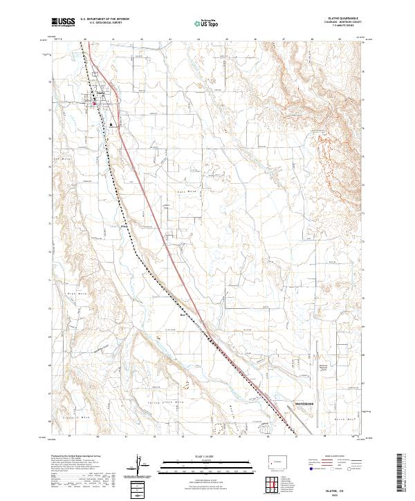
The Uncompahgre River defines the central corridor of this agricultural landscape, where an intricate network of irrigation systems like the Ironstone Canal, Selig Canal, and E Canal sustain the high plateau geography. The town of Olathe serves as the primary northern hub, characterized by its grid of streets such as Industrial Ave and proximity to the Olathe Cem. To the south, the expansion of Montrose is evident near the Montrose Regional Airport, marking the shift from rural cultivation to modern regional infrastructure.
Find a feature on this map
67 named features on this map. Tap any name to fly to it.
Don’t see what you’re looking for? This feature index may not catch every label — zoom into the map to look around manually.
Map Details
Editions of this 2022 Olathe Map
This is the sole edition of this map. No revisions or reprints were ever made.