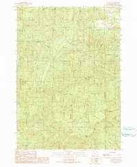
1990 Map of Old Blue
USGS Topo · Published 1990About this map
Old Blue Lookout Tower stands as the primary landmark in this Douglas County landscape, surveying a network of deeply etched drainages. The terrain is defined by its complex hydrology, where Little Camp Creek and Camp Creek converge from the west, while Belshazzar Creek and Hound Creek drain the southern reaches. The 1990 data reflects a working forest environment, evidenced by the presence of a Quarry and an extensive system of improved and unimproved roads. Notable heights like Rainy Peak provide significant relief above the creek beds, such as Lutsinger Creek to the north and Rader Creek to the southeast. This survey provides a clear view of the topographical transitions across the township lines of T 22 S through T 24 S, showing how these waterways dictated access and resource management in the late 20th century.
Find a feature on this map
22 named features on this map. Tap any name to fly to it.
Don’t see what you’re looking for? This feature index may not catch every label — zoom into the map to look around manually.
Map Details
Editions of this 1990 Old Blue Map
This is the sole edition of this map. No revisions or reprints were ever made.
Other maps of this area

1928 · Sitkum
USGS Topo · 1:125,000

1955 · Scottsburg
USGS Topo · 1:62,500

1955 · Ivers Peak
USGS Topo · 1:62,500

1955 · Tyee
USGS Topo · 1:62,500

1955 · Elkton
USGS Topo · 1:62,500

1958 · Roseburg
USGS Topo · 1:250,000

1959 · Roseburg
USGS Topo · 1:250,000

1979 · Roseburg
USGS Topo · 1:100,000

1979 · Cottage Grove
USGS Topo · 1:100,000
1985 · Loon Lake
USGS Topo · 1:24,000