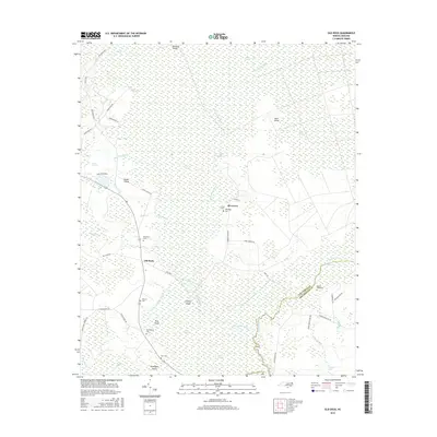
2016 Map of Old Dock
USGS Topo · Published 2016About this map
The Waccamaw River carves a winding path through the lowlands of Columbus County, defining a landscape of sprawling wetlands and named islands. In this riverine environment, settlements like Old Dock and Riverview occupy the higher ground between the swampy interior and the broader White Marsh. The map reveals a dense concentration of family burial grounds, such as Clewis Cem, Etheridge Cem, and Ross Cem, which provide significant genealogical touchstones for the area's long-established residents. The drainage patterns are meticulously documented, from the Mark Pine Canal to the natural flow of Gum Swamp Run and Juniper Cr. These waterways, alongside features like The Fishponds and Clifton Island, illustrate how the terrain dictated the development of roads like Crusoe Island Rd and Dock Rd, which navigate the few dry passages through the Green Swamp and surrounding basins.
Find a feature on this map
54 named features on this map. Tap any name to fly to it.
Don’t see what you’re looking for? This feature index may not catch every label — zoom into the map to look around manually.
Map Details
Editions of this 2016 Old Dock Map
This is the sole edition of this map. No revisions or reprints were ever made.
Other maps of this area
1942 · Juniper Creek
USGS Topo · 1:24,000
1943 · Pireway
USGS Topo · 1:31,680
1943 · Nakina
USGS Topo · 1:24,000
1943 · Freeland
USGS Topo · 1:24,000
1943 · Exum
USGS Topo · 1:24,000
1953 · Pireway
USGS Topo · 1:24,000
1953 · Florence
USGS Topo · 1:250,000
1954 · Florence
USGS Topo · 1:250,000
1954 · Bolton
USGS Topo · 1:62,500
1955 · Whiteville
USGS Topo · 1:62,500