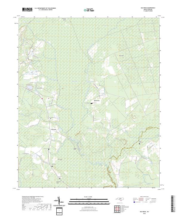
2022 Map of Old Dock
USGS Topo · Published 2022About this map
The Waccamaw River and the extensive wetlands of White Marsh dominate this part of Columbus County, where the landscape is defined by its transition between land and water. The small settlement of Old Dock sits at a critical junction near the river, while several family-named islands rise above the surrounding terrain, including Pine Island and Sweetgum Island. This area preserves a high density of rural burial sites, providing significant genealogical value through the Etheridge Cem, Clewis Cem, and Ross Cem. The presence of the Mark Pine Canal and The Fishponds suggests a history of water management and local resource utilization within the vast Green Swamp. Transport remains focused on rural routes like Hallsboro RD S and Crusoe Island RD, which connect these isolated riverine communities.
Find a feature on this map
56 named features on this map. Tap any name to fly to it.
Don’t see what you’re looking for? This feature index may not catch every label — zoom into the map to look around manually.
Map Details
Editions of this 2022 Old Dock Map
This is the sole edition of this map. No revisions or reprints were ever made.
Other maps of this area

1942 · Juniper Creek
USGS Topo · 1:24,000

1943 · Pireway
USGS Topo · 1:31,680

1943 · Nakina
USGS Topo · 1:24,000

1943 · Freeland
USGS Topo · 1:24,000

1943 · Exum
USGS Topo · 1:24,000
1953 · Pireway
USGS Topo · 1:24,000

1953 · Florence
USGS Topo · 1:250,000

1954 · Florence
USGS Topo · 1:250,000

1954 · Bolton
USGS Topo · 1:62,500

1955 · Whiteville
USGS Topo · 1:62,500