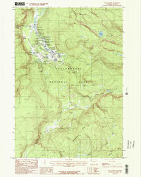
1986 Map of Old Faithful
USGS Topo · Published 1986About this map
Old Faithful and the concentrated thermal activity of the Upper Geyser Basin dominate this mid-1980s topographical survey of Yellowstone. The map documents the infrastructure surrounding the iconic basin, including the Old Faithful Geyser, a Trailer Park, and the Water Filtration Plant that supported the park's heavy visitation. Beyond the immediate visitor facilities, the landscape transitions into the wilder terrain of the Continental Divide and the Cement Hills.
Find a feature on this map
68 named features on this map. Tap any name to fly to it.
Don’t see what you’re looking for? This feature index may not catch every label — zoom into the map to look around manually.
Map Details
Editions of this 1986 Old Faithful Map
This is the sole edition of this map. No revisions or reprints were ever made.
Other maps of this area

1885 · Gallatin
USGS Topo · 1:125,000

1885 · Gallatin
USGS Topo · 1:125,000

1886 · Shoshone
USGS Topo · 1:125,000

1888 · Shoshone
USGS Topo · 1:125,000

1895 · Shoshone
USGS Topo · 1:125,000

1901 · Shoshone
USGS Topo · 1:125,000

1901 · Gallatin
USGS Topo · 1:125,000

1908 · Gallatin
USGS Topo · 1:125,000

1908 · Shoshone
USGS Topo · 1:125,000

1911 · Shoshone
USGS Topo · 1:125,000