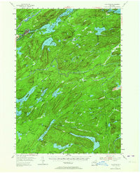
1954 Map of Old Forge
USGS Topo · Published 1964About this map
Fulton Chain Lakes dominate the northern landscape of this Adirondack region, where the settlement of Old Forge serves as a primary gateway to the wilderness. The mid-century topography reveals a mix of recreational development and inaccessible terrain, with remote outposts like Bisby Lodge, Mountain Lodge, and Forest Lodge established deep within the forest. These locations, alongside Gahans Farm, suggest the early-to-mid 20th-century transition of the area from a working landscape to a premier outdoor destination.
Find a feature on this map
143 named features on this map. Tap any name to fly to it.
Don’t see what you’re looking for? This feature index may not catch every label — zoom into the map to look around manually.
Map Details
Editions of this 1954 Old Forge Map
4 editions found

Other maps of this area

1897 · Remsen
USGS Topo · 1:62,500

1900 · Remsen
USGS Topo · 1:62,500

1900 · Canada Lake
USGS Topo · 1:62,500

1900 · Wilmurt
USGS Topo · 1:62,500

1901 · Old Forge
USGS Topo · 1:62,500

1902 · Wilmurt
USGS Topo · 1:62,500

1903 · Big Moose
USGS Topo · 1:62,500

1903 · West Canada Lakes
USGS Topo · 1:62,500

1903 · Raquette Lake
USGS Topo · 1:62,500

1904 · Piseco Lake
USGS Topo · 1:62,500