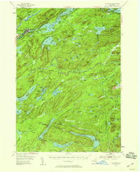
1954 Map of Old Forge
USGS Topo · Published 1959About this map
Old Forge serves as the gateway to the central Adirondacks in this mid-century survey, situated at the headwaters of the Moose River. The landscape is dominated by the Fulton Chain Lakes, with First Lake through Seventh Lake tracing a watery path through the high peaks. The topography reveals a region defined by recreational retreats and early twentieth-century seasonal residences, evidenced by the presence of Bisby Lodge, Mountain Lodge, and Forest Lodge.
Find a feature on this map
137 named features on this map. Tap any name to fly to it.
Don’t see what you’re looking for? This feature index may not catch every label — zoom into the map to look around manually.
Map Details
Editions of this 1954 Old Forge Map
4 editions found

Other maps of this area

1897 · Remsen
USGS Topo · 1:62,500

1900 · Remsen
USGS Topo · 1:62,500

1900 · Canada Lake
USGS Topo · 1:62,500

1900 · Wilmurt
USGS Topo · 1:62,500

1901 · Old Forge
USGS Topo · 1:62,500

1902 · Wilmurt
USGS Topo · 1:62,500

1903 · Big Moose
USGS Topo · 1:62,500

1903 · West Canada Lakes
USGS Topo · 1:62,500

1903 · Raquette Lake
USGS Topo · 1:62,500

1904 · Piseco Lake
USGS Topo · 1:62,500