
1897 Map of Remsen
USGS Topo · Published 1958About this map
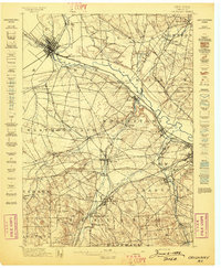
Industrial and transport arteries define this landscape at the edge of the Adirondacks, where the Black River Canal and several major railroads converge. The Adirondack Division and the Rome Watertown and Ogdensburg RR intersect near Remsen, while the New York Central and Hudson River RR follows the southern valley. These rail corridors supported small timber and milling hubs like Meekerville and Forestport.
Find a feature on this map
57 named features on this map. Tap any name to fly to it.
Don’t see what you’re looking for? This feature index may not catch every label — zoom into the map to look around manually.
Map Details
Editions of this 1897 Remsen Map
This is the sole edition of this map. No revisions or reprints were ever made.
Other maps of this area

1895 · Oriskany
USGS Topo · 1:62,500

1898 · Utica
USGS Topo · 1:62,500
1898 · Oriskany
USGS Topo · 1:62,500

1900 · Little Falls
USGS Topo · 1:62,500

1900 · Utica
USGS Topo · 1:62,500

1900 · Remsen
USGS Topo · 1:62,500

1900 · Wilmurt
USGS Topo · 1:62,500

1901 · Old Forge
USGS Topo · 1:62,500

1902 · Wilmurt
USGS Topo · 1:62,500

1903 · Little Falls
USGS Topo · 1:62,500