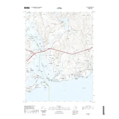
2021 Map of Old Lyme
USGS Topo · Published 2021About this map
Connecticut River serves as the dividing line between the coastal communities of Old Lyme and Old Saybrook in this contemporary digital survey. The landscape is defined by the complex estuary where the river meets Long Island Sound, featuring islands and marshlands like Great Island, Lord Cove, and Griswold Point. The shoreline is heavily developed with seasonal and year-round residential enclaves, including White Sands Beach, Sound View, and Fenwick. The map details the region's essential transportation infrastructure, tracing the Amtrak corridor and the Raymond E Baldwin Bridge which connects the two shores.
Find a feature on this map
210 named features on this map. Tap any name to fly to it.
Don’t see what you’re looking for? This feature index may not catch every label — zoom into the map to look around manually.
Map Details
Editions of this 2021 Old Lyme Map
This is the sole edition of this map. No revisions or reprints were ever made.
Other maps of this area

1892 · New London
USGS Topo · 1:62,500

1893 · New London
USGS Topo · 1:62,500

1893 · Saybrook
USGS Topo · 1:62,500

1903 · Gardiners Island
USGS Topo · 1:62,500

1904 · Gardiners Island
USGS Topo · 1:62,500

1921 · Gardiners Island
USGS Topo · 1:62,500

1921 · New London
USGS Topo · 1:62,500

1934 · Niantic
USGS Topo · 1:24,000

1935 · Montville
USGS Topo · 1:24,000

1938 · Niantic
USGS Topo · 1:62,500