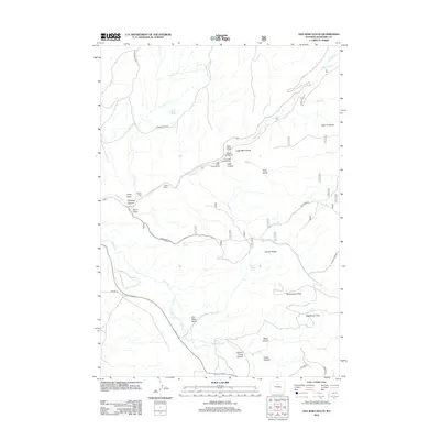
2012 Map of Old Maid Gulch
USGS Topo · Published 2012About this map
Tensleep Cr and its deep carved valleys define this portion of Washakie County, where the high desert terrain meets the infrastructure of the Tensleep Fish Hatchery. The landscape is a network of draws and flats, with Schoonover Flats and Sagebrush Flats providing relatively level ground above the steep descents of Black Canyon and Old Maid Gulch. Ranching and outdoor recreation are central to the area's identity, evidenced by the Circle J Ranch, Canyon Lodge, and established sites like the Leigh Creek Campground. Navigating the complex topography, Sand Draw Rd and S Brokenback Rd connect the isolated springs and landmarks, including the notable Leigh Monument situated near the head of Leigh Canyon.
Find a feature on this map
38 named features on this map. Tap any name to fly to it.
Don’t see what you’re looking for? This feature index may not catch every label — zoom into the map to look around manually.
Map Details
Editions of this 2012 Old Maid Gulch Map
This is the sole edition of this map. No revisions or reprints were ever made.
Other maps of this area

1899 · Cloud peak
USGS Topo · 1:125,000

1901 · Cloud Peak
USGS Topo · 1:125,000

1955 · Sheridan
USGS Topo · 1:250,000

1955 · Arminto
USGS Topo · 1:250,000

1958 · Sheridan
USGS Topo · 1:250,000

1958 · Arminto
USGS Topo · 1:250,000

1962 · Sheridan
USGS Topo · 1:250,000

1962 · Arminto
USGS Topo · 1:250,000

1966 · Monument Hill
USGS Topo · 1:24,000

1966 · Big Trails NE
USGS Topo · 1:24,000