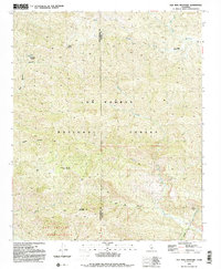
1991 Map of Old Man Mountain
USGS Topo · Published 1991About this map
Old Man Mountain stands as a central landmark within the Los Padres National Forest, marking a landscape defined by dramatic elevation changes along the border of Santa Barbara and Ventura counties. This 1991 survey illustrates the complex drainage systems of the transverse ranges, where Matilija Creek and North Fork Juncal Creek carve through steep canyons. Traces of human activity are concentrated around small outposts like Upper Hartman Ranch and La Carpa Potreros, or the isolated Monte Arido summit. Historical land divisions are preserved in the mapping of the Los Prietos y Najalayegua Grant Boundary, reflecting the region's transition from Spanish land grants to protected federal forest. The map also records essential water sources in this arid environment, including La Carpa Spring and a remote Water Tank located near the peak of Old Man Mountain.
Find a feature on this map
25 named features on this map. Tap any name to fly to it.
Don’t see what you’re looking for? This feature index may not catch every label — zoom into the map to look around manually.
Map Details
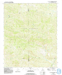
Editions of this 1991 Old Man Mountain Map
2 editions found
Other maps of this area

1902 · Santa Ynez
USGS Topo · 1:125,000

1903 · Mt. Pinos
USGS Topo · 1:125,000

1904 · Ventura
USGS Topo · 1:62,500

1905 · Santa Ynez
USGS Topo · 1:125,000

1941 · Ventura
USGS Topo · 1:62,500

1942 · Wheeler Springs
USGS Topo · 1:24,000

1943 · Rancho Nuevo Creek
USGS Topo · 1:24,000

1943 · Old Man Mountain
USGS Topo · 1:24,000

1943 · Reyes Peak
USGS Topo · 1:24,000

1943 · Wheeler Springs
USGS Topo · 1:24,000