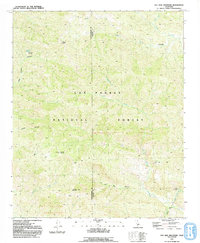
1991 Map of Old Man Mountain
USGS Topo · Published 1991About this map
Los Padres National Forest contains a complex network of high peaks and drainage basins along the border of Santa Barbara and Ventura counties. Compiled from 1987 aerial photography, this topographic record details the high-elevation terrain around Old Man Mountain and Monte Arido, where the headwaters of several significant drainages originate. The map illustrates a landscape defined by sharp elevation changes, with Sespe Creek and Matilija Creek cutting through the interior.
Find a feature on this map
22 named features on this map. Tap any name to fly to it.
Don’t see what you’re looking for? This feature index may not catch every label — zoom into the map to look around manually.
Map Details
Editions of this 1991 Old Man Mountain Map
2 editions found
Other maps of this area

1902 · Santa Ynez
USGS Topo · 1:125,000

1903 · Mt. Pinos
USGS Topo · 1:125,000

1904 · Ventura
USGS Topo · 1:62,500

1905 · Santa Ynez
USGS Topo · 1:125,000

1941 · Ventura
USGS Topo · 1:62,500

1942 · Wheeler Springs
USGS Topo · 1:24,000

1943 · Rancho Nuevo Creek
USGS Topo · 1:24,000

1943 · Old Man Mountain
USGS Topo · 1:24,000

1943 · Reyes Peak
USGS Topo · 1:24,000

1943 · Wheeler Springs
USGS Topo · 1:24,000