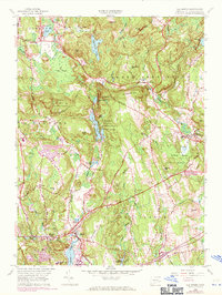
1958 Map of Old Mystic
USGS Topo · Published 1971About this map
Old Mystic and its surrounding hill country are captured here at a moment of transition, showing the enduring boundaries of the Pequot Indian Reservation and the Eastern Tribe reservation lands. The landscape is characterized by a series of north-south glacial ridges and wetlands, including Long Pond and Assekonk Swamp. Cultural landmarks like the Mystic Oral Sch and the Hewitt Sch sit alongside historic routes such as the Pequot Trail and Trolley Road. To the east, North Stonington remains a focal point of settlement, while the Pawcatuck State Forest defines the southeastern terrain. A unique layer of purple revisions from 1970 highlights the encroaching modernization of the highway system and residential expansion over the 1942 and 1958 base surveys, specifically noting developments near Burnetts Corner.
Find a feature on this map
74 named features on this map. Tap any name to fly to it.
Don’t see what you’re looking for? This feature index may not catch every label — zoom into the map to look around manually.
Map Details
Editions of this 1958 Old Mystic Map
2 editions found
Other maps of this area

1889 · Stonington
USGS Topo · 1:62,500

1889 · Moosup
USGS Topo · 1:62,500

1892 · New London
USGS Topo · 1:62,500

1892 · Norwich
USGS Topo · 1:62,500

1893 · Moosup
USGS Topo · 1:62,500

1893 · Stonington
USGS Topo · 1:62,500

1893 · New London
USGS Topo · 1:62,500

1920 · Moosup
USGS Topo · 1:62,500

1921 · New London
USGS Topo · 1:62,500

1921 · Stonington
USGS Topo · 1:62,500