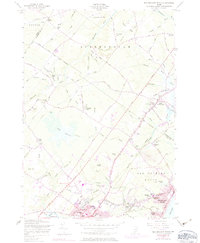
1956 Map of Old Orchard Beach
USGS Topo · Published 1983About this map
Old Orchard Beach and the adjacent shores of Saco Bay define the coastal character of this mid-century landscape. The map illustrates a dense concentration of civic and religious institutions, including the Campground Tabernacle, Jameson School, and the grounds of Thornton Academy. The commercial and social fabric of the era is evident in the inclusion of the Beech Ridge Speedway and the Drive-in Theater, reflecting the automotive culture that began to dominate the region following the construction of the Maine Turnpike.
Find a feature on this map
92 named features on this map. Tap any name to fly to it.
Don’t see what you’re looking for? This feature index may not catch every label — zoom into the map to look around manually.
Map Details
Editions of this 1956 Old Orchard Beach Map
4 editions found
Other maps of this area

1891 · Portland
USGS Topo · 1:62,500

1891 · Biddeford
USGS Topo · 1:62,500

1891 · Kennebunk
USGS Topo · 1:62,500

1891 · Buxton
USGS Topo · 1:62,500

1892 · Buxton
USGS Topo · 1:62,500

1893 · Kennebunk
USGS Topo · 1:62,500

1893 · Biddeford
USGS Topo · 1:62,500

1893 · Portland
USGS Topo · 1:62,500

1893 · Buxton
USGS Topo · 1:62,500

1898 · Kennebunk
USGS Topo · 1:62,500