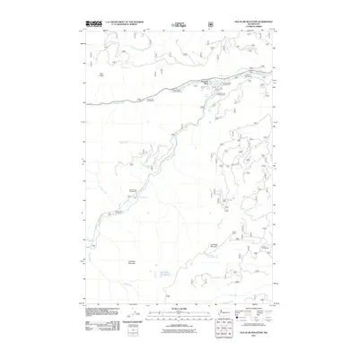
2011 Map of Old Scab Mountain
USGS Topo · Published 2011About this map
American River serves as the central artery for this mountainous region of Yakima County, where the river's confluence with the Bumping River defines the local geography. The landscape is characterized by high peaks such as Old Scab Mountain and Little Bald Mountain, providing a haven for seasonal recreation and forest management. A distinct cluster of seasonal residences is located at Sleepy Hollow Summer Homes, positioned near the waterway and the various forest service roads that weave through the valley.
Find a feature on this map
29 named features on this map. Tap any name to fly to it.
Don’t see what you’re looking for? This feature index may not catch every label — zoom into the map to look around manually.
Map Details
Editions of this 2011 Old Scab Mountain Map
This is the sole edition of this map. No revisions or reprints were ever made.
Other maps of this area

1901 · Snoqualmie Pass
USGS Topo · 1:125,000

1902 · Mount Aix
USGS Topo · 1:125,000

1903 · Snoqualmie
USGS Topo · 1:125,000

1904 · Mt Aix
USGS Topo · 1:125,000

1950 · Yakima
USGS Topo · 1:250,000

1957 · Wenatchee
USGS Topo · 1:250,000

1958 · Yakima
USGS Topo · 1:250,000

1961 · Yakima
USGS Topo · 1:250,000

1961 · Easton
USGS Topo · 1:62,500

1962 · Bumping Lake
USGS Topo · 1:62,500