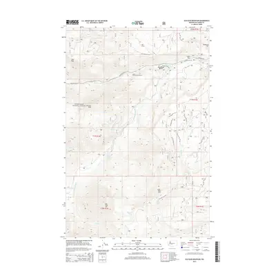
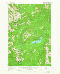
2014 Map of Old Scab Mountain
USGS Topo · Published 2014About this map
American River and the nearby Sleepy Hollow Summer Homes serve as the primary hubs of seasonal residency and travel within this high-elevation corridor of the Snoqualmie National Forest. The landscape is defined by the convergence of the American River and the Bumping River, which flow through a series of steep ridges and flats. High points like Old Scab Mtn, Little Bald Mtn, and Fifes Ridge dominate the topography, while the lower elevations are marked by critical water sources such as Soda Springs, Willow Springs, and Flat Iron Lake. A complex network of Forest Service roads, including Nat For Dev Rd 1600 and Nat For Dev Rd 1910, branch off from State Hwy 410, illustrating how logging and recreation access were managed in the central Cascades during the early 21st century.
Find a feature on this map
39 named features on this map. Tap any name to fly to it.
Don’t see what you’re looking for? This feature index may not catch every label — zoom into the map to look around manually.
Map Details
Editions of this 2014 Old Scab Mountain Map
This is the sole edition of this map. No revisions or reprints were ever made.
Other maps of this area
1901 · Snoqualmie Pass
USGS Topo · 1:125,000
1902 · Mount Aix
USGS Topo · 1:125,000
1903 · Snoqualmie
USGS Topo · 1:125,000
1904 · Mt Aix
USGS Topo · 1:125,000

1950 · Yakima
USGS Topo · 1:250,000
1957 · Wenatchee
USGS Topo · 1:250,000

1958 · Yakima
USGS Topo · 1:250,000
1961 · Yakima
USGS Topo · 1:250,000
1961 · Easton
USGS Topo · 1:62,500
1962 · Bumping Lake
USGS Topo · 1:62,500