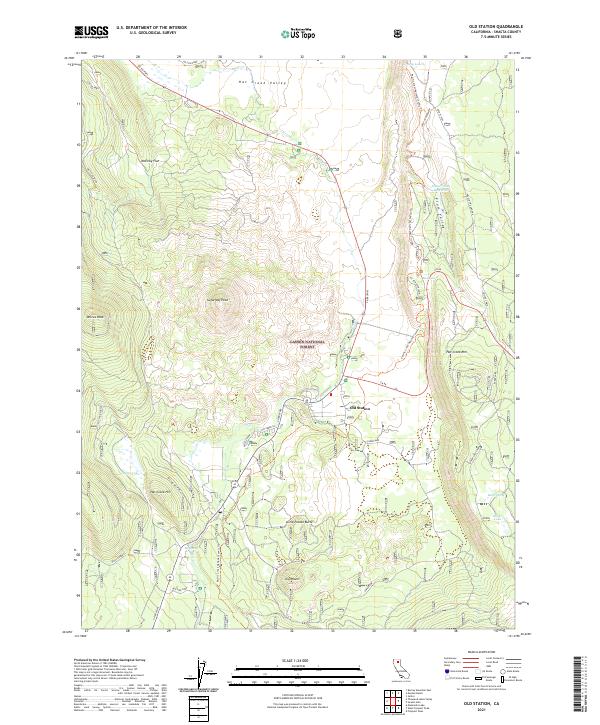
2021 Map of Old Station
USGS Topo · Published 2021About this map
Old Station serves as a central point in this northern California landscape, positioned at the junction of Ca 89 and Ca 44. The area is defined by its volcanic topography and water features, situated within the Lassen National Forest. To the east, the dramatic rise of the Hat Creek Rim dominates the horizon, while the Hat Creek Valley provides a level floor for the northward-flowing Hat Creek.
Find a feature on this map
35 named features on this map. Tap any name to fly to it.
Don’t see what you’re looking for? This feature index may not catch every label — zoom into the map to look around manually.
Map Details
Editions of this 2021 Old Station Map
This is the sole edition of this map. No revisions or reprints were ever made.
Other maps of this area

1886 · Lassen Peak
USGS Topo · 1:250,000

1892 · Lassen Peak
USGS Topo · 1:250,000

1894 · Lassen Peak
USGS Topo · 1:250,000

1935 · Burney
USGS Topo · 1:96,000

1939 · Burney
USGS Topo · 1:125,000

1939 · Halls Flat
USGS Topo · 1:125,000

1955 · Westwood
USGS Topo · 1:250,000

1956 · Manzanita Lake
USGS Topo · 1:62,500

1957 · Prospect Peak
USGS Topo · 1:62,500

1957 · Burney
USGS Topo · 1:62,500