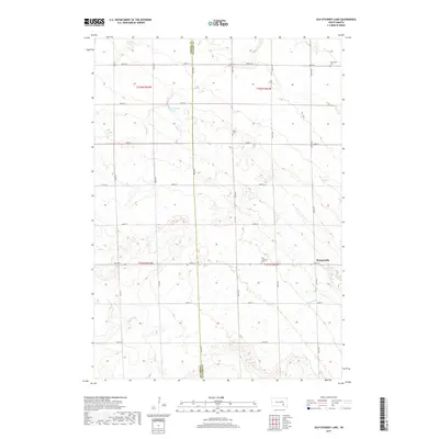
2017 Map of Old Stickney Lake
USGS Topo · Published 2017About this map
Stickney Lake and Old Stickney Lake sit at the intersection of Aurora and Davison Counties in this South Dakota prairie landscape. The area is defined by its agricultural grid, marked by several local burial grounds including the Nicolaisen Cem, Union Cem, and Zion Lutheran Cem. These sites, along with the settlement of Metzgerville, provide anchor points for genealogists researching the families who settled this region of the eastern Great Plains. The hydrology of the area is centered around the shallow basins of the namesake lakes and the drainage of Twelvemile Cr in the southeastern corner. This survey documents the rural infrastructure as it stood in 2017, showing the established section lines and rural road network that has structured this landscape since the early days of its township organization.
Find a feature on this map
30 named features on this map. Tap any name to fly to it.
Don’t see what you’re looking for? This feature index may not catch every label — zoom into the map to look around manually.
Map Details
Editions of this 2017 Old Stickney Lake Map
This is the sole edition of this map. No revisions or reprints were ever made.
Other maps of this area

1899 · Mitchell
USGS Topo · 1:125,000

1955 · Mitchell
USGS Topo · 1:250,000

1959 · Mitchell
USGS Topo · 1:250,000
1979 · Hillside
USGS Topo · 1:24,000

1980 · Stickney
USGS Topo · 1:24,000

1980 · Corsica Lake
USGS Topo · 1:24,000

1980 · Old Stickney Lake
USGS Topo · 1:24,000
1980 · Mitchell SW
USGS Topo · 1:24,000

1980 · Mount Vernon
USGS Topo · 1:24,000
1980 · Betts
USGS Topo · 1:24,000