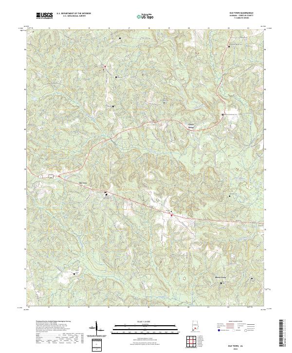
2024 Map of Old Town
USGS Topo · Published 2024About this map
Old Town and Mount Union anchor this detailed study of south-central Alabama's rural landscape, where the Sepulga River meanders through the eastern reaches of the quadrangle. The area is defined by a dense network of family-named landmarks and small burial grounds, such as the King Family Cem and Hall Cem, which reflect generations of local settlement. The spiritual center of the community is evident in sites like the Saint John Baptist Church Cem at Old Town, Grace Independent Baptist Cem, and Welcome Methodist Cem. Transportation across the river and its tributaries, including Old Town Creek and Piney Woods Creek, is facilitated by crossings like Travis Bridge. The topography is etched with numerous local roads like Will Lynch Rd and King Rd, showing the persistent rural character of Conecuh County.
Find a feature on this map
70 named features on this map. Tap any name to fly to it.
Don’t see what you’re looking for? This feature index may not catch every label — zoom into the map to look around manually.
Map Details
Editions of this 2024 Old Town Map
This is the sole edition of this map. No revisions or reprints were ever made.
Other maps of this area

1953 · Andalusia
USGS Topo · 1:250,000

1957 · Andalusia
USGS Topo · 1:250,000

1971 · Lyeffion
USGS Topo · 1:24,000

1971 · Brooks
USGS Topo · 1:24,000

1971 · Mc Kenzie
USGS Topo · 1:24,000

1971 · Loango
USGS Topo · 1:24,000

1971 · Garland
USGS Topo · 1:24,000

1982 · Evergreen
USGS Topo · 1:24,000

1982 · Nymph
USGS Topo · 1:24,000

1982 · Old Town
USGS Topo · 1:24,000