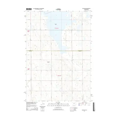
2015 Map of Oldham NW
USGS Topo · Published 2015About this map
Coteau des Prairies, a vast glacial upland, dominates this landscape in eastern South Dakota at the border of Kingsbury and Miner Counties. The northern portion is marked by the southern reach of Lake Thompson, which transitions into the low-lying Vermillion Flats. The terrain here is defined by subtle elevation changes that direct the drainage toward the E Fork Vermillion River, which meanders through the eastern townships. This rural expanse is organized by a precise grid of section-line roads, including 438th Ave and 220th St. A key point of interest for genealogists and local historians is the Berton Cem located in the southwest, representing one of the few named landmarks in this predominantly agricultural region.
Find a feature on this map
26 named features on this map. Tap any name to fly to it.
Don’t see what you’re looking for? This feature index may not catch every label — zoom into the map to look around manually.
Map Details
Editions of this 2015 Oldham NW Map
This is the sole edition of this map. No revisions or reprints were ever made.
Other maps of this area

1899 · De Smet
USGS Topo · 1:125,000

1953 · Watertown
USGS Topo · 1:250,000

1958 · Watertown
USGS Topo · 1:250,000

1968 · Oldham SW
USGS Topo · 1:24,000

1968 · Lake Preston East
USGS Topo · 1:24,000

1968 · Lake Preston West
USGS Topo · 1:24,000

1968 · Oldham NW
USGS Topo · 1:24,000

1968 · Oldham
USGS Topo · 1:24,000

1968 · Oldham SE
USGS Topo · 1:24,000

1971 · Howard NE
USGS Topo · 1:24,000