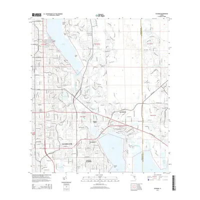
2015 Map of Oldsmar
USGS Topo · Published 2015About this map
Lake Tarpon and its southern drainage define the landscape of this Pinellas County corridor during a period of significant suburban integration. The map illustrates the specialized infrastructure connecting northern settlements like Innisbrook and Curlew to the larger centers of Clearwater and Dunedin. Local history and genealogy interest is anchored by Parklawn Cem and educational sites such as the Central Florida Institute.
Find a feature on this map
116 named features on this map. Tap any name to fly to it.
Don’t see what you’re looking for? This feature index may not catch every label — zoom into the map to look around manually.
Map Details
Editions of this 2015 Oldsmar Map
This is the sole edition of this map. No revisions or reprints were ever made.
Other maps of this area

1921 · Sand Key
USGS Topo · 1:62,500

1921 · St Petersburg
USGS Topo · 1:62,500

1943 · Gandy Bridge
USGS Topo · 1:31,680

1943 · Safety Harbor
USGS Topo · 1:31,680

1943 · Dunedin
USGS Topo · 1:31,680

1943 · Tarpon Springs
USGS Topo · 1:31,680

1943 · Clearwater
USGS Topo · 1:24,000

1943 · Odessa
USGS Topo · 1:24,000

1943 · Elfers
USGS Topo · 1:24,000

1943 · Oldsmar
USGS Topo · 1:24,000