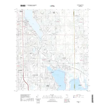
2018 Map of Oldsmar
USGS Topo · Published 2018About this map
Lake Tarpon dominates the upper reaches of this coastal landscape, situated north of the expansive waters of Old Tampa Bay. The area shows a dense network of suburban development stretching from Tarpon Springs in the north down toward Clearwater and Dunedin. The eastern shoreline of the bay is marked by Philippe Point and the town of Safety Harbor, where the grid of residential streets meets the natural inlets of Safety Harbor.
Find a feature on this map
132 named features on this map. Tap any name to fly to it.
Don’t see what you’re looking for? This feature index may not catch every label — zoom into the map to look around manually.
Map Details
Editions of this 2018 Oldsmar Map
This is the sole edition of this map. No revisions or reprints were ever made.
Other maps of this area

1921 · Sand Key
USGS Topo · 1:62,500

1921 · St Petersburg
USGS Topo · 1:62,500

1943 · Gandy Bridge
USGS Topo · 1:31,680

1943 · Safety Harbor
USGS Topo · 1:31,680

1943 · Dunedin
USGS Topo · 1:31,680

1943 · Tarpon Springs
USGS Topo · 1:31,680

1943 · Clearwater
USGS Topo · 1:24,000

1943 · Odessa
USGS Topo · 1:24,000

1943 · Elfers
USGS Topo · 1:24,000

1943 · Oldsmar
USGS Topo · 1:24,000