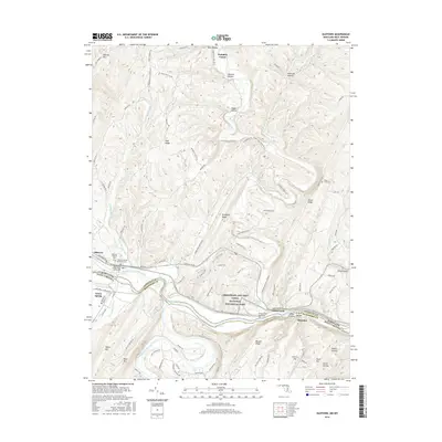
2016 Map of Oldtown
USGS Topo · Published 2016About this map
Oldtown serves as a historic focal point along the northern banks of the Potomac River, where the landscape is defined by the sharp bends of the river and the legacy of early American transportation. This 2016 survey documents the enduring presence of the Chesapeake and Ohio Canal, now protected within the Chesapeake and Ohio Canal National Historical Park. A notable architectural landmark, the Town Creek Aqueduct, stands where Town Creek meets the Potomac, illustrating the engineering required to navigate this ridge-and-valley terrain. On the West Virginia side of the river, small settlements like Green Spring and Okonoko mark the valley floor, while the rugged heights of Warrior Mtn and Green Ridge dominate the Maryland horizon. The map is particularly useful for genealogical research, identifying several local burial sites including the Oldtown Catholic Cem, Oldtown United Methodist Cem, and the uniquely named Fifty-Four Cem to the east.
Find a feature on this map
101 named features on this map. Tap any name to fly to it.
Don’t see what you’re looking for? This feature index may not catch every label — zoom into the map to look around manually.
Map Details
Editions of this 2016 Oldtown Map
This is the sole edition of this map. No revisions or reprints were ever made.
Other maps of this area

1891 · Romney
USGS Topo · 1:125,000

1894 · Winchester
USGS Topo · 1:125,000

1898 · Paw Paw
USGS Topo · 1:62,500

1899 · Flintstone
USGS Topo · 1:62,500

1900 · Pawpaw
USGS Topo · 1:62,500

1900 · Flintstone
USGS Topo · 1:62,500

1910 · Paw Paw
USGS Topo · 1:62,500

1916 · Capon Bridge
USGS Topo · 1:62,500

1921 · Hanging Rock
USGS Topo · 1:48,000

1923 · Capon Bridge
USGS Topo · 1:62,500