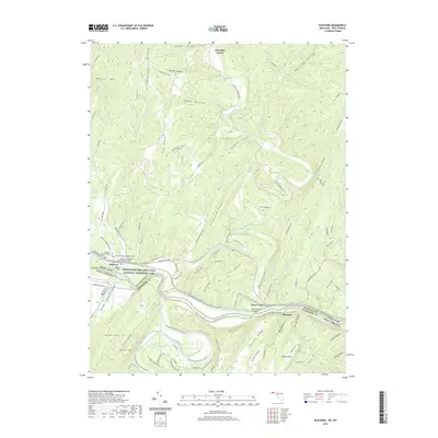
2019 Map of Oldtown
USGS Topo · Published 2019About this map
Oldtown serves as a focal point along the northern banks of the Potomac River, where the historic Chesapeake and Ohio Canal National Historical Park follows the winding waterway. The landscape is defined by the sharp ridges of Warrior Mtn and Pine Ridge, which channel drainage into Town Creek and its many tributaries like Sawpit Run and Seven Springs Run. This 2019 survey documents the enduring layout of rural Allegany County, showing a network of mountain roads such as Teter Hill Rd and Old Sawmill Rd that connect isolated hollows.
Find a feature on this map
107 named features on this map. Tap any name to fly to it.
Don’t see what you’re looking for? This feature index may not catch every label — zoom into the map to look around manually.
Map Details
Editions of this 2019 Oldtown Map
This is the sole edition of this map. No revisions or reprints were ever made.
Other maps of this area

1891 · Romney
USGS Topo · 1:125,000

1894 · Winchester
USGS Topo · 1:125,000

1898 · Paw Paw
USGS Topo · 1:62,500

1899 · Flintstone
USGS Topo · 1:62,500

1900 · Pawpaw
USGS Topo · 1:62,500

1900 · Flintstone
USGS Topo · 1:62,500

1910 · Paw Paw
USGS Topo · 1:62,500

1916 · Capon Bridge
USGS Topo · 1:62,500

1921 · Hanging Rock
USGS Topo · 1:48,000

1923 · Capon Bridge
USGS Topo · 1:62,500