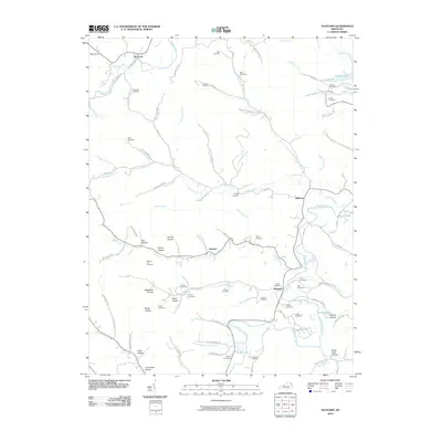
2010 Map of Oldtown
USGS Topo · Published 2010About this map
Warnock Po and the surrounding valley along Tygarts Creek anchor this rural landscape in Greenup County. The terrain is defined by a dense network of hollows and ridges, such as Claylick Ridge and Hanner Hollow, which have dictated the placement of small communities like Samaria and Oldtown. The 2010 survey highlights a significant concentration of family burial grounds including Rose Cemetery, Bays Cemetery, and Warnock Cemetery, providing a detailed record for genealogical research in this part of Kentucky. Waterways like the Little Sandy River and Greenbo Lake shape the eastern half of the map, while numerous branches and forks like Pruitt Fork and Buffalo Branch drain the wooded uplands. This map illustrates a region where local geography is deeply tied to family names and the winding paths of creek-side roads.
Find a feature on this map
116 named features on this map. Tap any name to fly to it.
Don’t see what you’re looking for? This feature index may not catch every label — zoom into the map to look around manually.
Map Details
Editions of this 2010 Oldtown Map
This is the sole edition of this map. No revisions or reprints were ever made.
Other maps of this area

1903 · Kenova
USGS Topo · 1:125,000

1904 · Kenova
USGS Topo · 1:125,000

1915 · Garrison
USGS Topo · 1:62,500

1918 · Garrison
USGS Topo · 1:62,500

1926 · Greenup
USGS Topo · 1:48,000

1930 · Greenup
USGS Topo · 1:62,500

1949 · Brushart
USGS Topo · 1:24,000

1950 · Brushart
USGS Topo · 1:24,000

1950 · Grahn
USGS Topo · 1:24,000

1950 · Tygarts Valley
USGS Topo · 1:24,000