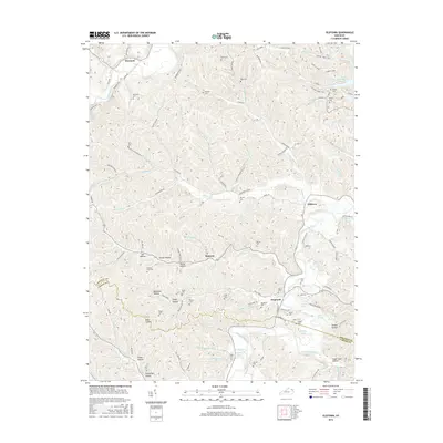
2016 Map of Oldtown
USGS Topo · Published 2016About this map
Oldtown and Warnock anchor this part of Greenup County, where the landscape is defined by the winding Little Sandy River and Tygarts Creek. The terrain is a network of named hollows and ridges, from Holbrook Ridge to Sugar Cane Hollow, reflecting a deeply dissected plateau. This 2016 survey documents a rural environment where numerous family-named burial grounds like Warnock Cem, Buffalo Cem, and Hickory Flat Cem remain as vital genealogical links. The road system, featuring the Michael Tygart Trail and Claylick Loop, follows the natural contours of the land, connecting small settlements like Samaria and Hopewell. Water features such as Anglin Pond and Martin Pond dot the drainage basins of Crane Creek and Oldtown Cr, illustrating the hydraulic patterns of this Appalachian foothill region.
Find a feature on this map
113 named features on this map. Tap any name to fly to it.
Don’t see what you’re looking for? This feature index may not catch every label — zoom into the map to look around manually.
Map Details
Editions of this 2016 Oldtown Map
This is the sole edition of this map. No revisions or reprints were ever made.
Other maps of this area
1903 · Kenova
USGS Topo · 1:125,000
1904 · Kenova
USGS Topo · 1:125,000
1915 · Garrison
USGS Topo · 1:62,500
1918 · Garrison
USGS Topo · 1:62,500
1926 · Greenup
USGS Topo · 1:48,000
1930 · Greenup
USGS Topo · 1:62,500
1949 · Brushart
USGS Topo · 1:24,000
1950 · Brushart
USGS Topo · 1:24,000
1950 · Grahn
USGS Topo · 1:24,000
1950 · Tygarts Valley
USGS Topo · 1:24,000