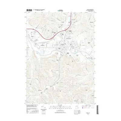
2016 Map of Olean
USGS Topo · Published 2016About this map
Olean sits at a geographic crossroads in the Southern Tier, where the Allegheny River and Olean Creek define the valley floor. This survey documents the city and its surrounding satellite neighborhoods, including Boardmanville, North Olean, and South Olean. To the west, the campus of Saint Bonaventure Univ and the village of Allegany are prominent, situated near the Wnyp RR corridor that historically drove regional industry.
Find a feature on this map
125 named features on this map. Tap any name to fly to it.
Don’t see what you’re looking for? This feature index may not catch every label — zoom into the map to look around manually.
Map Details
Editions of this 2016 Olean Map
This is the sole edition of this map. No revisions or reprints were ever made.
Other maps of this area

1898 · Olean
USGS Topo · 1:62,500

1900 · Salamanca
USGS Topo · 1:62,500

1924 · Bradford
USGS Topo · 1:62,500

1926 · Bradford
USGS Topo · 1:62,500

1933 · Smethport
USGS Topo · 1:62,500

1937 · Smethport
USGS Topo · 1:62,500

1938 · Salamanca
USGS Topo · 1:62,500

1938 · Olean
USGS Topo · 1:62,500

1941 · Bradford
USGS Topo · 1:62,500

1943 · Olean
USGS Topo · 1:62,500