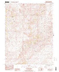
1985 Map of Olinghouse
USGS Topo · Published 1985About this map
The high desert landscape of the Pah Rah Range dominates this 1980s study of Washoe County. The small settlement of Olinghouse serves as the focal point for local history, closely associated with the nearby Olinghouse Mine and the rugged drainage of Olinghouse Canyon. This area reflects a classic Nevada pattern of isolated ranching and mining outposts tucked into the folds of the mountains, as evidenced by Home Ranch situated near Quaking Aspen Spring and Twin Springs. The topography is defined by numerous deep cuts, including Wilcox Canyon and Pierson Canyon, while the northeastern corner reaches into the Pyramid Lake Indian Reservation. Genealogists and historians will find interest in the scattered water sources essential for survival in this environment, from Sheehan Spring to the intermittent Cottonwood Creek, alongside landmarks like Pond Peak and White Hill.
Find a feature on this map
30 named features on this map. Tap any name to fly to it.
Don’t see what you’re looking for? This feature index may not catch every label — zoom into the map to look around manually.
Map Details
Editions of this 1985 Olinghouse Map
2 editions found
Other maps of this area

1890 · Wadsworth
USGS Topo · 1:125,000

1891 · Reno
USGS Topo · 1:125,000

1892 · Wadsworth
USGS Topo · 1:125,000

1893 · Reno
USGS Topo · 1:125,000

1894 · Wadsworth
USGS Topo · 1:125,000

1957 · Sutcliffe
USGS Topo · 1:62,500

1957 · Spanish Springs Valley
USGS Topo · 1:62,500

1957 · Wadsworth
USGS Topo · 1:62,500

1957 · Nixon
USGS Topo · 1:62,500

1957 · Reno
USGS Topo · 1:250,000